Mine Subsidence Board:
DocuMap
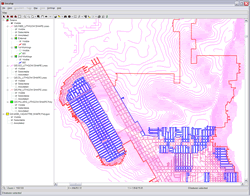
DocuMap GIS viewer and query tool
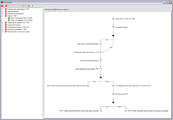
DocuMap workflow modeling
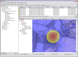
DocuMap with buffer
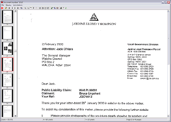
Viewing a scanned document found in DocuMap
project name
Mine Subsidence Board - DocuMap
the aim
The Mine Subsidence Board (MSB) realised that it needed to replace its existing Information Management System (IMS) with a more modern, reliable and efficient system. Spatial Intelligence is part of a consortium that won a tender to supply and implement the new IMS. Other members of the consortium include NGIS, Pellion and Alpha West.
The new IMS included Office software, GIS, document/records management and property management software. The new system needed to operate in WAN environment and be easy to use, robust, timely and efficient.
the solution
A solution is based on the following components:- Microsoft Windows
- Microsoft Office
- Oracle 9i
- ESRI ArcGIS
- DocuMap
All of the IMS data is stored in Oracle 9i in a fully replicated system to meet the requirements of the distributed environment. As most of the information that the MSB deals with has a spatial component ESRI's ArcGIS is central to he solution.
- GIS viewing and querying - A core tool required by most of the MSB personnel is the GIS viewing and querying tool in DocuMap. This is used to view and query the MSB's large GIS datasets
- Workflow - DocuMaps' workflow is used by DocuMap and other IMS systems to manage the MSB's business processes
- Microsoft Office integration
- Integration with the property management system
Tags
more details
For more details please use our 'Contact us' page or email us at info@spatialintelligence.com.au